
Yard Drainage in Avila Beach
Paso Robles Landscaping designs and builds yard drainage for Avila Beach homes: downspouts led into planting, gravel swales across hillside yards, permeable paths and parking pads, rain gardens where the soil drains, and solid pipe to a safe outlet where it does not. Avila Beach is unincorporated and sits wholly inside the Coastal Zone, so the rules come from the County of San Luis Obispo’s Coastal Zone Land Use Ordinance and the San Luis Bay Area Plan, not a city code. We plan each yard around those County standards, the flat town’s high water table and the slopes above it. For a site visit, call 805-712-4440 or use the contact form.
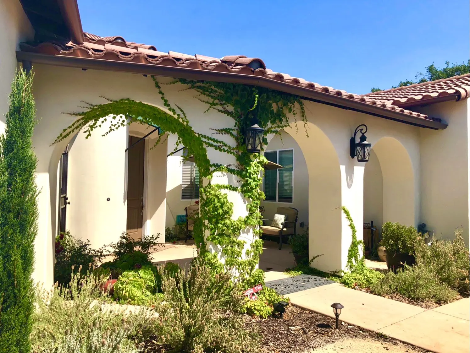
This page is about moving rain water on private lots in and around Avila Beach. Planting, irrigation and general yard work in town are covered on our Avila Beach landscaping page, bluff-top drainage under City of Pismo Beach rules is on yard drainage in Pismo Beach, and inland County lots are covered by yard drainage in Nipomo. We point to those pages rather than repeat them.
County Rules That Shape Drainage in Avila Beach
Every row below cites a County of San Luis Obispo or Avila Beach Community Services District source. We read each one on October 20, 2026.
| Topic | What the source says | Source |
|---|---|---|
| When a drainage plan is needed | A plan goes in with the building, grading or land use application for sites on slopes steeper than 10 percent, within 50 feet of a mapped watercourse, in a Flood Hazard area, next to a coastal bluff, prone to ponding, or where the work would change how water leaves the lot | Coastal Zone Land Use Ordinance 23.05.042 |
| Grading permit scope | Needed for grading and fill, and also for paving or surfacing that changes an existing offsite drainage pattern, unless an exemption in 23.05.026 applies | CZLUO 23.05.025 |
| Small cut and fill | Excavation under two feet deep, and fill under one foot on gentle ground or under three feet when it carries no structure, stays at or below 50 cubic yards per lot and blocks no drainage course, are listed as exempt | CZLUO 23.05.026(f) and (g) |
| Rainy-season grading | Permitted grading done or left unfinished between October 15 and April 15 needs an erosion and sedimentation control plan approved by the County Engineer first | CZLUO 23.05.036 |
| Avila Beach homes | New residential development in the Avila Beach urban area uses runoff controls: fewer hard surfaces, roof and driveway water sent across planted strips, on-site percolation, sized to the 85th percentile storm | San Luis Bay Area Plan, Avila Beach residential standards |
| Bluff lots | Pipes that discharge onto the bluff, beach or intertidal area are prohibited unless the water cannot feasibly be held on site, spread on pervious ground or sent to the street | CZLUO 23.05.050(d) |
| Natural channels | Projects keep offsite natural drainage patterns, and drainage courses stay natural rather than channelized | CZLUO 23.05.050(b) |
| Building permit screening | Public Works screens permits on slopes of 10 percent or more, in flood hazard areas or with erosion potential | County Public Works |
| Rain barrels | Systems holding up to 360 gallons for outdoor use need no permit | County rain barrel factsheet |
| Pool and spa water | Overflow onto paving that drains to a storm drain is prohibited; sewer discharge needs the sewer provider’s OK first | County pool drainage factsheet |
Drainage Work We Install on Avila Beach Lots
Most yards need a combination. A hillside lot might get a gravel swale, a planted strip at the toe and a piped catch basin by the garage; a flat lot in town might get permeable paving, shallow beds and an overflow route to the street.
- Downspouts redirected into mulched planting, a gravel strip or a lawn edge so roof water slows down and soaks in before anything reaches the street
- Shallow rock-filled infiltration trenches and small soak-away pits, sized only after a percolation test shows the ground will actually take the water
- Rain gardens: shallow planted dips with an overflow path, placed on gentle ground and well away from the house
- Cobble- or gravel-lined swales that carry hillside runoff across a slope at an easy grade instead of straight down it
- Permeable pavers, gravel and decomposed granite in place of solid paving for paths, side yards and parking pads
- Catch basins and solid pipe that move water from low corners to an approved outlet, with cleanouts so the line can be flushed
- Rain barrels and small cisterns on roof downspouts, kept under the size the County lets you install without a permit
- Erosion control for bare ground: jute or coir netting, mulch, straw wattles and native seed before the first storms
Three Kinds of Avila Beach Lot, Three Drainage Problems
The flat townsite near the beach and creek mouth. The streets between the beach and Avila Beach Drive sit only a few feet above sea level. The County’s Avila Beach Drainage Project page explains that the corner of First Street and San Francisco Street and the public parking lot flood repeatedly through the year because of their low elevation, and the posted studies describe high groundwater that limits how much ponded water can soak in. On these lots we test the soil before trusting any infiltration design, keep trenches shallow, and always give water a surface overflow path toward the street.
Hillside streets and the slopes above town. Homes above Front Street, in San Luis Bay Estates and on the hillsides of Avila Valley often sit on grades over 10 percent, which by itself triggers a County drainage plan when a permit is involved. Here the risk is speed: water that runs straight down a slope cuts gullies, undermines steps and walls, and lands on the neighbor below. We break the slope with cross swales, set rock at outlets, and keep the soil covered.
Bluff-top and creekside parcels. Along the bay front and above the beach, water has to be held on site, spread over planted ground or sent to the street rather than piped over the edge. In Avila Valley, lots along San Luis Obispo Creek may be in a Flood Hazard area or within 50 feet of the mapped creek, and either condition brings a County drainage plan and extra care with grading.
What the First Street Flooding Study Means for Your Yard
The County’s project documents, a 2015 conceptual design report and a 2024 pump station feasibility study, describe how the town drains. Runoff from the low streets collects in gutters, open channels and a swale and passes under Avila Beach Drive into San Luis Obispo Creek through an outlet fitted with a duckbill check valve. When the estuary is high, the valve stays shut and water backs up into the street and parking lot until the level drops. A sand bar at the creek mouth can cut the creek off from the ocean and raise it further. When flooding is bad enough, County road crews close the intersection and pump water out.
No private yard can fix that, and the County is working on it, with a 30 percent design under way and Coastal Commission and Regional Water Board approvals still ahead. What a homeowner can do is avoid adding to the problem. That means letting roof water soak into planted ground where the soil allows, using gravel or open-jointed pavers instead of new solid paving, and accepting that in the lowest part of town, deep soakaways may sit in groundwater for part of the winter. In those spots we lean on surface storage in beds and shallow basins and design for slow release, not on a pit that is already full.
The Avila Beach Residential Storm Drainage Standard
The San Luis Bay Area Plan (Coastal) carries standards written just for the Avila Beach urban area, which takes in the Avila townsite, the Port San Luis Harbor District lands along the bay front, San Luis Bay Estates, Pirates Cove and Avila Valley. For the residential land use categories, the Storm Drainage standard says new residential development shall use BMPs, the pollution-control measures named in the California stormwater handbook, to address polluted runoff. It lists the expected ones: cutting back impervious surfaces such as solid driveways and walks, sending water from roofs and drives across vegetated strips before it leaves the lot, and managing runoff on site with something like a percolation basin. Planted roadside swales are encouraged and count toward the total, and the whole set is sized to treat and infiltrate runoff up to the 85th percentile storm.
The Avila Beach Specific Plan, adopted with the same standards, also calls for drainage swales on the hillside residential streets so that no extra water reaches the beach. For a homeowner, the practical message is simple: on a new home or a major addition in Avila Beach, the County will expect runoff to be slowed and filtered on the lot, and a well-planned landscape is usually where that happens. You can find both plans on the County’s Avila Beach planning documents page.
Grading and Drainage Permits in the Coastal Zone
Title 23 of the County Code is the Coastal Zone Land Use Ordinance, and its Chapter 23.05 sets the site rules. A few points come up on nearly every Avila Beach drainage job:
- Paving can count as grading. Section 23.05.025 requires a grading permit not only for cuts and fills but for any paving, surfacing or other construction that changes an existing offsite drainage pattern, including the direction, speed or volume of flow. A new driveway that sheds water onto a neighbor is a permit question, not just a design one.
- The exemptions are narrow. Shallow excavation and modest fill are exempt under 23.05.026, but the fill exemption ends at 50 cubic yards per lot and disappears if the fill blocks a drainage course. Some utility trenching exemptions also do not apply in Coastal Commission appealable areas or within 100 feet of an environmentally sensitive habitat.
- A grading permit may be your coastal permit. For work not otherwise needing a land use permit, grading permit approval also serves as the coastal development permit; where the grading is appealable to the Coastal Commission, a Minor Use Permit is required too.
- Bigger or riskier jobs go to an engineer. Grading of 5,000 cubic yards or more, on slopes of 30 percent or steeper, or in a Flood Hazard or geologic study area has to be prepared and certified by a registered civil engineer.
- What a basic drainage plan shows. Section 23.05.044 lists flow lines on and off the site, existing and finished contours, pad, floor and street elevations, swales and berms, basins and pipes, runoff estimates, erosion control and any flood-proofing the County Engineer asks for.
Section 23.05.050 adds the design rules: keep natural drainage patterns, avoid channelizing drainage courses, limit peak runoff to pre-development levels when required, and on downhill lots, encourage drainage easements across lower properties so water can be released to the street. Section 23.05.050(h) asks new development to minimize impervious area so more water soaks in. If work was done without a permit, the County’s grading page explains that an as-built grading permit can carry violation fees and may require digging out and replacing soil as a licensed engineer directs.
Bluff-Top Lots Above the Bay
Section 23.05.050(d) is direct about coastal bluffs. Stormwater outfalls to the bluff, the beach, the intertidal area or the ocean are prohibited unless it has been shown that holding the water on site, spreading it on pervious ground or sending it to the street is not feasible without causing flooding or erosion. Where an outfall is the only option, it needs filtration and treatment, has to be screened from public view and needs every agency approval. Any development on a site next to a bluff also triggers a drainage plan under 23.05.042. In practice we keep bluff-side yards planted and slightly crowned away from the edge, collect roof water into shallow beds near the house, and route overflow toward the street side of the lot.
Creekside Lots in Avila Valley
San Luis Obispo Creek runs past Avila Valley to the ocean at the edge of town, and the area plan records flood damage in low-lying parts of Avila Valley in 1969 and 1973. Under 23.05.034(f), grading may not alter a stream or natural water body shown on a USGS quadrangle map except under a County drainage plan and a streambed alteration agreement from the California Department of Fish and Wildlife, and watercourses may not be blocked without an approved alternative. Excavated soil cannot be stockpiled where high water can carry it off, and equipment may not cross a live stream without County-approved siltation controls. Section 23.05.050(c) keeps structures out of areas the County Engineer finds subject to flooding unless the hazard is addressed, and applies the National Flood Insurance Program rules as a minimum. If your lot borders the creek, a call to Public Works comes before any design.
Rainy Season, Bare Soil and Erosion Control
Under 23.05.036, permitted grading carried out or left unfinished between October 15 and April 15 needs an erosion and sedimentation control plan, prepared by a civil engineer or other professional the County Engineer accepts. The same section requires slopes to be stabilized during work, interceptor swales at the top of cut and fill slopes where runoff could erode them, and permanent cover on disturbed ground within 30 days of finishing grading. Section 23.05.034(g) asks that topsoil be saved and spread back over finished slopes, and that permanent planting start no later than six months after final grades.
For small yard projects that never need a permit, we still follow the same habits: work in dry weather when we can, wattle the downhill edge before digging, cover stockpiles, and leave nothing bare going into a storm. The County’s stormwater-at-home page points homeowners to a 2019 County Standard Seed Mix of low-growing, low fire risk native plants for covering bare soil, which suits slopes that also need to stay lean for fire safety.
Weeds, Fire Safety and Runoff
The Avila Beach Community Services District provides water, sewer, fire protection and street lighting for the town, and its weed abatement notice asks residents to cut their weeds to keep Avila safe from fire. CAL FIRE Station 62 is listed among the agencies serving Avila Beach. Mowing a dry hillside is the right call before fire season, but a slope scraped down to bare dirt in summer is the slope that washes out in January. We cut fuel without stripping roots, mow rather than disc on steep ground, and add mulch, netting or seed where the cover gets thin.
Pools, Spas and the Sewer
The County’s pool and spa drainage factsheet affects many coastal yards. Letting a pool or spa overflow onto a sidewalk, driveway, street or other paving that drains to a public storm drain is prohibited. The preferred way to empty one is to let the water soak slowly into your own landscaping once chlorine is at or below 0.1 mg/L and pH sits between 7.0 and 8.0, as long as it stays on the property. Sending it to the sanitary sewer requires contacting your sewer provider first, which in town is the Avila Beach CSD, and the storm drain is the last choice, allowed only after County Public Works approves the route. Saltwater pool water may go to neither the sewer nor the storm drain. When we build drainage near a pool, we leave a planted area that can take a slow drawdown.
Rain Barrels and Rain Gardens
The County’s rain barrel factsheet lets you install up to 360 gallons of rain storage for outdoor use with no permit. Openings need screen against mosquitoes, barrels should be labeled as non-potable rain water, and tall narrow tanks should be no more than twice as high as they are wide. A barrel will not hold a whole storm, so its overflow is piped into a bed or swale like any other downspout.
Rain gardens work well on the hillside lots, where the soil is often better drained than in the flats. The County-hosted homeowner rainwater guide keeps them at least 10 feet from foundations, off slopes of 15 percent or more and away from septic systems, and expects the ponded water to be gone within 72 hours; slow soils need an underdrain. We run a simple percolation test before choosing a size, and on the low streets near the creek mouth we often skip infiltration altogether.
The Street Side of Your Lot
Many Avila Beach drainage plans end by sending overflow to the street, which the ordinance favors over a bluff or creek outlet. Anything built in the County road strip, such as a pipe through the curb or a cut in the gutter, is County right-of-way work that needs a County encroachment permit, and it is done by a contractor holding the license and permit the County requires for that work. Paso Robles Landscaping builds the drainage on your lot and stops at the property line, and we hand our outlet elevations to whoever holds the permit for the street piece. Public Works at 805-781-5252 can tell you what is allowed on your street.
How an Avila Beach Drainage Job Runs
- Watch the water. We visit, ideally during or right after rain, mark where water enters, stands and leaves the lot, and note slope, soil, bluff or creek edges and the street.
- Check the County conditions. We look at slope, flood hazard mapping and watercourse distance, and ask the County when a drainage plan, grading permit or coastal permit may apply.
- Test the soil. A percolation test tells us whether trenches and rain gardens will drain or whether the yard needs surface storage and pipe.
- Design the route. You get a sketch showing each downspout, swale, bed and outlet, with an engineer brought in where the County requires stamped plans.
- Build with controls in place. Wattles, covered stockpiles and a clean entrance go in first; then grading, rock, pipe, paving and planting.
- Test and hand over. We run water through every inlet, show you the cleanouts, and leave a short care list for before and after the storm season.
Agencies to Contact
- County Public Works (drainage and flood screening, road strip, storm drains). 976 Osos Street, Room 206, San Luis Obispo; 805-781-5252.
- County Planning and Building (grading, building and coastal permits). 805-781-5600; applications through PermitSLO.
- Avila Beach Community Services District (water, sewer, fire protection). 100 San Luis Street, Avila Beach; 805-595-2664.
- Underground utilities. Call 811 before digging.
Paso Robles Landscaping holds California contractor license CSLB #986950. This page summarizes public County of San Luis Obispo and Avila Beach CSD documents to help you plan. It is not legal advice or an engineering design, and our crew are not County staff, civil engineers or geologists. The County decides when a drainage plan, grading permit or coastal permit applies; a registered civil engineer prepares plans when the County requires one; and work in the County road strip goes through a County encroachment permit. When a rule is unclear for your parcel, we ask the County before we build.
More Guides for Avila Beach and Nearby Coastal Yards
Related guides for Avila Beach and for drainage elsewhere in the county:
- Landscaping in Avila Beach
- Yard drainage in Pismo Beach
- Yard drainage in San Luis Obispo
- Yard drainage in Arroyo Grande
- Yard drainage in Nipomo
- Yard drainage in Morro Bay
- Yard drainage in Cayucos
- Yard drainage in Grover Beach
- Yard drainage in Oceano
- Landscaping in Shell Beach
- Outdoor living on Shell Beach bluff lots
- Retaining walls in San Luis Obispo
- Mulch and rock installation
- Fire-safe landscaping
All of the communities we work in are listed on the San Luis Obispo County service area page.
Frequently Asked Questions
Do I need a County permit to fix drainage in my Avila Beach yard?
Small work such as redirecting downspouts, planting and shallow trenches often needs none, but the Coastal Zone ordinance requires a grading permit for grading and for any paving or surfacing that changes how water leaves your lot, and a drainage plan on slopes over 10 percent, near a mapped watercourse, in a Flood Hazard area or next to a coastal bluff. We check with County Planning and Building (805-781-5600) before starting anything that may need one.
Why does water stand in my yard near the beach after a storm?
The low part of town sits only a few feet above sea level. County studies for the First Street drainage project describe high groundwater and a creek outlet that closes when the estuary is high, so the ground and the storm drain can both be full at the same time. Shallow beds, permeable surfaces and a surface overflow route usually work better there than a deep soakaway.
Can I pipe my roof water over the bluff to the beach?
Generally no. The ordinance prohibits outfalls to the bluff, beach, intertidal area or ocean unless keeping the water on site, spreading it on pervious ground or sending it to the street is shown not to be feasible, and any allowed outfall needs treatment, screening and agency approvals.
Will you put a drain pipe through the curb to the street?
We build the drainage on your property up to the property line. A pipe through the curb or any other work in the County road strip needs a County encroachment permit and is done by a contractor holding the license and permit the County requires for that work; we match our outlet to it.
Do I need a permit for a rain barrel in Avila Beach?
No permit is needed for rain barrel systems holding up to 360 gallons for outdoor use, according to the County factsheet. Screen the openings, label the barrel as rain water that is not for drinking, and pipe the overflow into planting.
Planning Drainage Work in Avila Beach?
Tell us where the water goes on your lot. At the site visit we trace the flow, check slope, bluff and creek conditions, and give you a free written estimate.
Call 805-712-4440 Get a Free Estimate
Paso Robles Landscaping · 1345 Riverside Ave, Paso Robles · Licensed contractor, CSLB #986950 · Serving all of San Luis Obispo County